Photos of the Day
Haida Gwaii, British Columbia
and
Tuktoyaktuk, Northwest Territories
(Summer 2023)
Since the photos of my US travels were so popular, I decided to continue sharing my adventures with you. I have just returned from Haida Gwaii and Meghan has uploaded some of the photos sharing what I found so encouraging. We hear so many bad news stories about First Nations communities but this appears to be a good news story.

Right now I am grounded in the Prince George area getting over what I hope is a bad cold. I have no fever and have not lost smell or taste so hopefully not COVID. Never the less, I'm playing it safe. As soon as I'm road worthy, I will make my way north.
I drove the Dempster to Inuvik in 2009 and thoroughly enjoyed it. My dream has been to drive it again later in the season to experience the changing colors. And as soon as I heard that the Dempster was extended to Tuktoyaktuk, I had even more incentive to make the trip. It's a long drive and a lot can happen along the way. Consider joining me on the trip. I will send photos and stories back periodically.
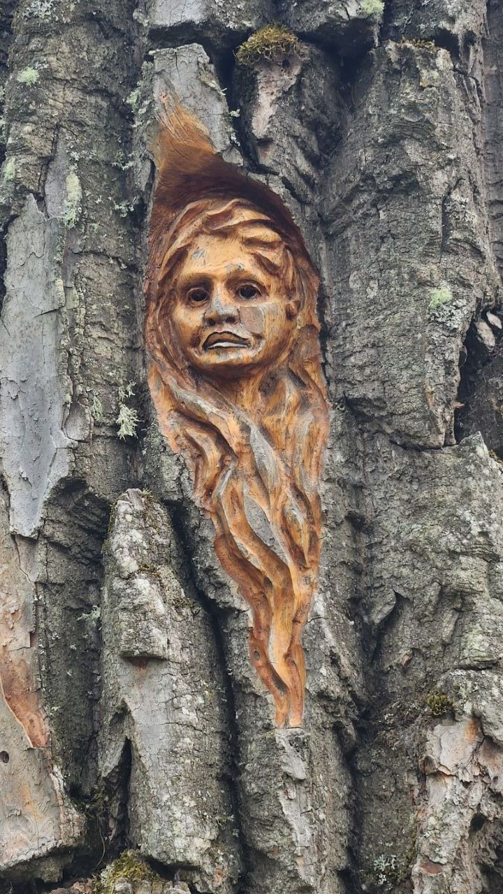
July 15 - Tree carving by Elmer Gunderson
Cottonwood Island Park, Prince George
This tree carving by local artist Elmer Gunderson can be found at Cottonwood Island Park in downtown Prince George.
I found at least a dozen of these whimsical spirit carvings in the cottonwood trees. They change a pleasant riverside stroll into a treasure hunt.
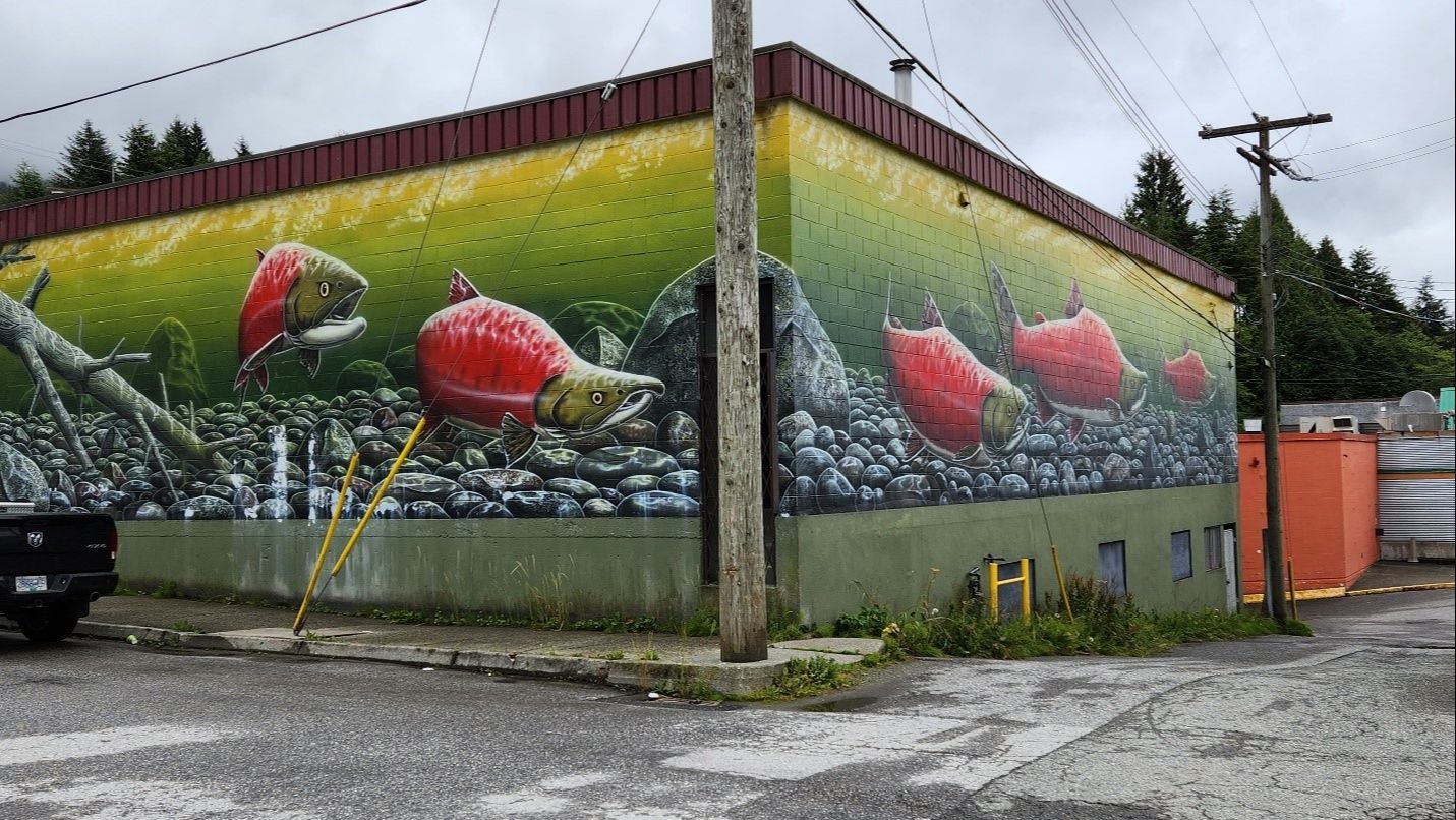
July 18 - Mural by Jeff King
Prince Rupert
Prince Rupert is a city of extremes.
When the fisheries closed, and logging decreased, the population fell from 20,000 to less than 12,000. There is a lot of poverty. Yet the city is filled with beautiful murals like this one by Nanaimo artist Jeff King. It really makes walking around town interesting.
You learn to keep your head up. And people are resourceful and responding to tourist trends. I was able to get gluten-free fish and chips - yumm and there is a “keto” deli where I bought snacks for the ferry ride.
I definitely get a hit of dopamine when stumbling upon such finds.
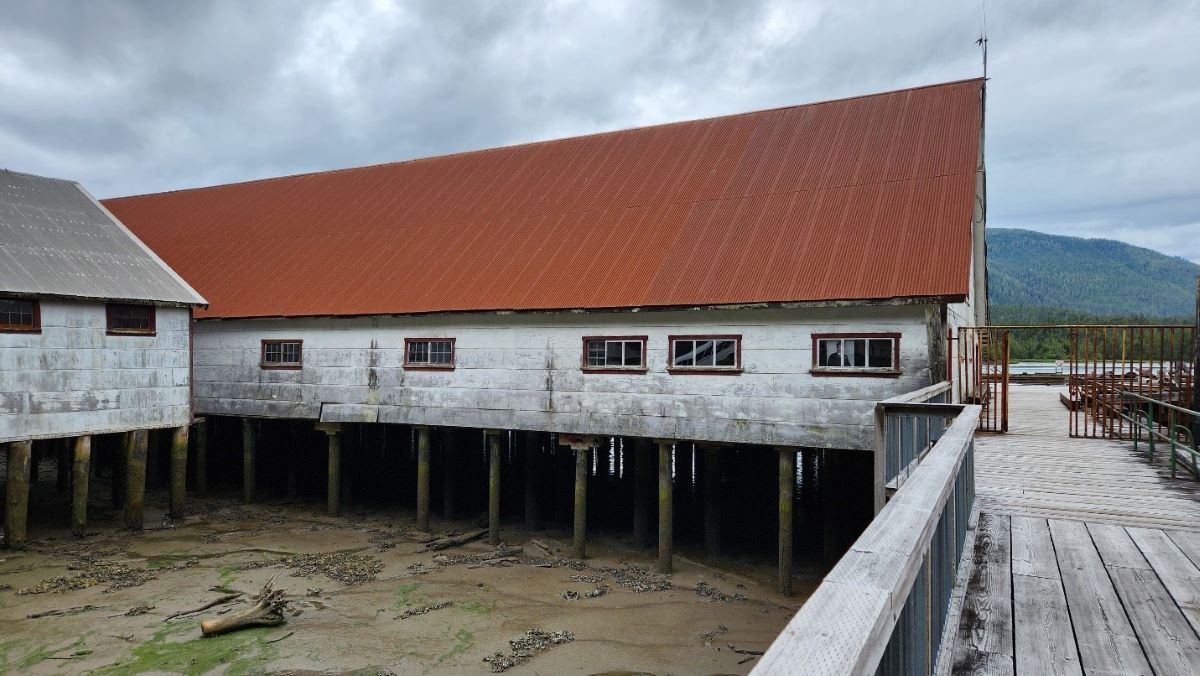
July 19 - The Pacific Northwest Cannery National Museum
The Pacific Northwest Cannery was last active in 1972. It is now a national museum. It is a reminder of a past we don’t want repeated. The workers in the over 200 canneries along the coast were like indentured servants. They were secluded and forced to buy all their supplies from the company store. Many ended the season in debit. Only the European workers were allowed to eat in the cafeteria. The others, Indigenous, Chinese, and Japanese had to somehow find their own food. Each race was housed in segregated accommodations. The Indigenous workers brought their families, and everyone worked, men fished and canned. The women and children mended the nets - for little or no pay.
July 20 - Boat Trip to the Khutzeymateen


The boat trip to the Khutzeymateen wilderness to see the Grizzly bears who dig for clams. was magical. So serene and only a couple other boats on the water that day. It is a protected area, untouched except for a couple of small eco-lodges. The bears are recently out of hibernation and still pretty skinny. But they were hard at work finding clams and muscles, and didn’t even look up as we slowly motored by.
A friend commented that the second photo shows a “bear bum”.
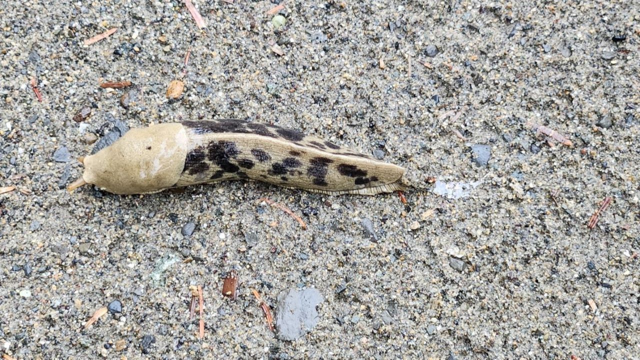
July 22 - The banana slugs of Haida Gwaii
The 1000+ islands of Haida Gwaii off the northwest coast of BC get more rain than anywhere else in Canada (over 265 days/year). The landscape there is green and lush, full of the red cedars which the indigenous Haida people used for all their needs including longhouses, totem poles, clothing, and tools.
I had been warned by a woman I met earlier on my trip about the large slugs on Haida Gwaii and these banana slugs did not disappoint. They are about the size of my hand and so gorgeous. Apparently, they sometimes drop out of trees onto the heads of unsuspecting walkers.
This did not happen to us.
July 23 - Tourism in Haida Gwaii
Tourism on Haida Gwaii is in its infancy. We were lucky enough to attend two dinners put on by local women including this one featuring an introduction to the culture and dance. The Haida are making impressive strides to rebuild their culture and economy. Their population was decimated almost as soon as Europeans came to the area in the 1860’s. Smallpox killed over 95% of the 20,000 inhabitants of Haida Gwaii. The fewer than 1000 survivors were pushed to leave their villages and resettle in the two main communities of Skidegate and Masset where they were forbidden to speak their language, practice their culturally significant potlatches, or to carve totem poles. Miraculously, some survivors remembered stories from their childhood and began resurrecting the culture in the late 1960s.
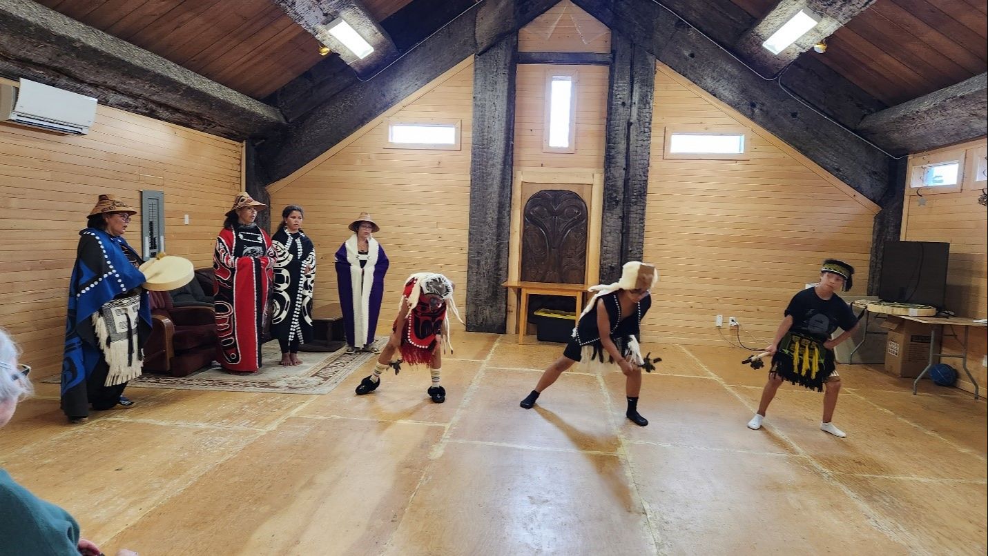
On May 9th, 2023, the government of BC recognized the Haida Nation’s inherent right to govern their territory. They now control all resource extraction decisions. They have closed down most clear cutting. They are managing their fisheries and stocks are starting to recover. The young people we talked to are big advocates of their governance and are hopeful for the future. The Council of the Haida Nation financially supports post-secondary education for all students who keep their grades up and most go to universities on the mainland. One young man I met is studying archeology and plans to write the definitive history of his people. Among first nations in Canada, the Haida seems to be an example of success.
July 23 - The Golden Spruce
Haidi Gwaii
Do you know the story of the Golden Spruce? The Haida can tell it better than me.
There was a genetic variant golden sitka spruce in a forest near the village of Gamadiis (Port Clements). A misguided soul cut it down with a chainsaw in 1997. The locals took some cuttings from the tree and are regrowing them. There are apparently 5 all together and three are in secret locations for their own protection!
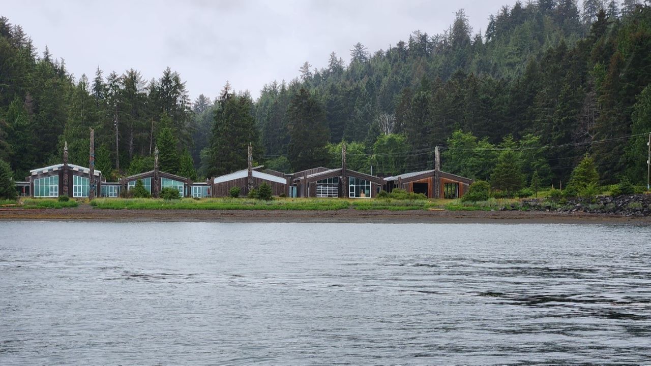
July 24 - Longhouses
Haida Heritage Centre
This is a view of the longhouses of the Haida Heritage Centre from the water giving a hint of what Haida villages looked like before colonization. Of course, they didn’t have windows or glass back then. But as in the photo, each longhouse had a totem pole in front letting people arriving by canoe know who lived there and how powerful they were by the number of potlatch rings on their totem.
August 1 - Carp Lake Provincial Park
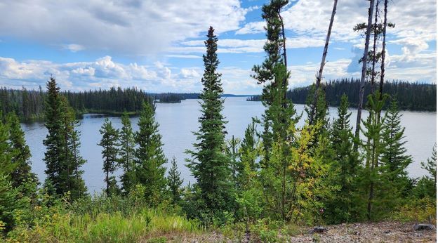
When I was finally able to drive again, I found this gem location l, Carp Lake Provincial Park. This was the view from my van. The sky over the lake was enormous. I was able to see storms coming in ahead of the downpours. Sadly, there were a lot of black flies here so I wasn’t sitting out at my picnic table much.
August 3 - Carvings
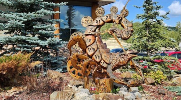
Imagine pulling into a small northern BC town, hoping against hope to get some cough lozenges to stop the fits of coughing from my stubborn cold now definitely overstaying its welcome. And then to find that the first pharmacy you go in has your very favorite brand of lozenges (Ricola sugar free echinacea), one that even in Calgary, I often have a hard time finding! Then walking to the Visitor Information Centre and being given a map of over 200 unique wood carvings done by carvers from all over the world. So, map in hand I spend a couple of hours wandering around Chetwyn BC admiring carvings like this one aptly called “Killing Time”. It is a goal of my holiday to embrace slow travel.
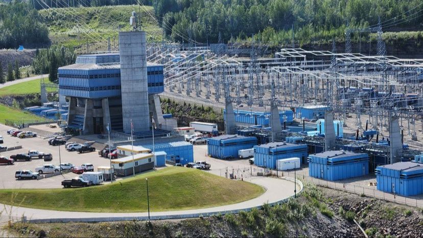
August 4 - Bennet Dam

It just keeps getting better and better. I decided to go check out the WAC Bennett Dam which supplies >30% of BC’s power - and is near Hudson’s Hope BC, a conveniently short drive from Chetwynd. I arrive at the dam site just after opening, amazing already for someone who used to have ME and rarely got up before 11 am. I was asked if I wanted to go on the guided tour. "Of course," I say. Another motto for my year 2023 is “say yes to life”.
So, I get a tag and go downstairs to board the bus. I notice that I’m the only white person on the bus. I’m wondering to myself why a group of apparently indigenous leaders are on this BC Hydro tour. As soon as we drive over the dam, none of the indigenous people are looking at the dam. They are all exclaiming about the three golden eagles flying back and forth overhead. OMG, I have never positively identified a golden eagle and here I have a dozen experts who are certain that is what we are looking at. From this view, you’ll have to trust me on this one.
After the tour, I watched the recommended video about how the indigenous nations nearby were impacted when the water rose on the Peace River in 1969. They weren’t even notified and some on the water at the time nearly drowned. Not only that. Even though the flooding took place on their land, they don’t benefit from the clean power produced. To this day, at least some of the nations have to pay BC Hydro for dirty diesel generated power.
After the video I begin talking to one of the indigenous women and she explains that a new dam has just been completed and will start flooding the Peace from the existing dam to Fort St. John 81 km away. This time, the local First Nations are at least aware of the plans. Based on the negative impact to their culture (loss of hunting grounds, houses, possessions and grave sites), They have been fighting the new dam called Site C unsuccessfully for decades.
It turns out the group on the bus were Watchpeople - employed by BC Hydro to watch the outcomes of the rising water. I’m using this term I learned on Haida Gwaii. They have watchmen located at all of their ancient sites to educate visitors and protect the sites. This time they have made some effort to save the animals. Over 200 bear dens were relocated this year in preparation for the flooding. Last time thousands of animals drowned. They asked me to take their group photo. It was an honor. At least someone is paying attention and we are making some progress in respecting the lives and culture of the First Nations.
The second photo is Site C, the new almost finished third dam to provide BCs increasing power needs. If you look carefully towards the top right, you will see the high voltage power lines already in place to take the power generated to Vancouver. They have had thousands of people working on this for 15 years. They have an onsite accommodation the size of 4 large hotels and most of the workers fly in and out for 2 weeks shifts from all over Canada and the world. It’s a massive undertaking.
August 7 - Caribou
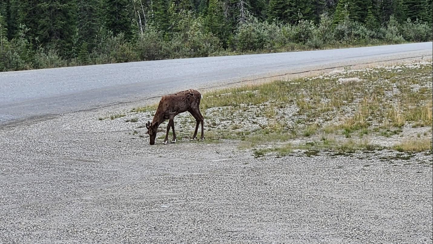
A young caribou is attracted to something at roadside. It (males and females have the same size antlers) barely looked up when I pulled into the roadside pullout at approximately km 385 of the Alaska highway. I love the white booties caribou have (distinguishing them from other ungulates) and how they run … prance really. They are so light on their feet. One can picture then pulling Santa’s sleigh. I believe north American caribou and European reindeer are closely related.
August 7 - Sunset at Liard Hot Springs

Sunset at Liard Hot Springs (km 764 of the Alaska Highway). It had rained hard in the afternoon and there was a beautiful rainbow at a moment when I did not have a camera on me. So I went back to the hot springs boardwalk after dinner. The rainbow had gone but I was treated to this - the steam from the hot water rising and the sun setting.
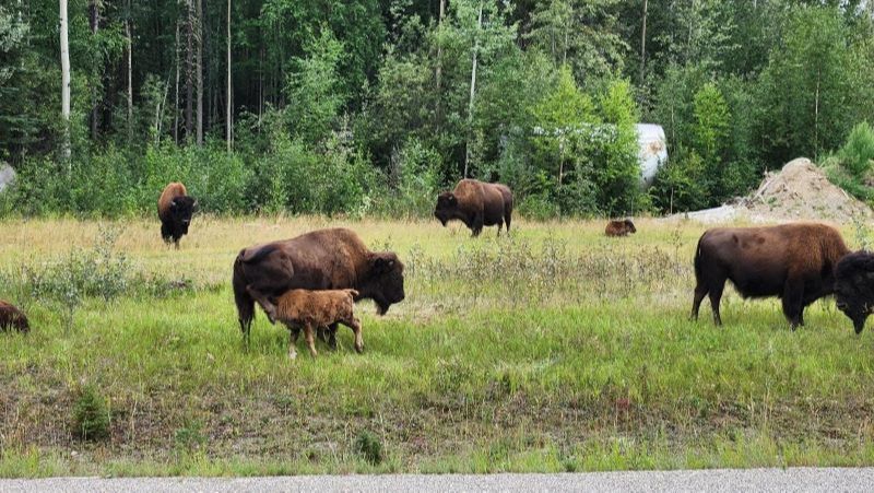
August 8 - Wood Bison
I had been hoping to see bison and was not disappointed. I ran into this herd just west of Liard Hotsprings. Even though they are Wood Bison (the smaller cousins of the plains bison at Elk Island Park near Edmonton) they looked pretty big to me. They get the right of way crossing the highway.
August 9 - Yukon Skies

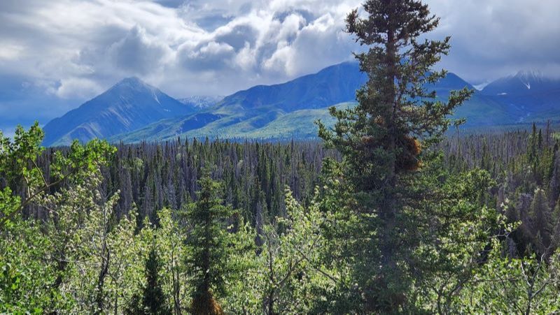
I’m not sure why but the skies up here in the Yukon seem enormous. This view is from the campground at Teslin Lake. And in the few hours of the late afternoon to early evening, the weather changed several times, from pelting rain to bright sun and everything in between. One certainly can’t take the weather for granted up here.

August 10
Atlin, BC Bike Ride
Riding around Atlin, BC. On the way to Whitehorse, I took a detour on the impossibly beautiful Atlin Road to the town of Atlin which proudly states there is no cell coverage. It is filled with wood heritage buildings from 100 years ago, left over from the gold rush days. There are small lodges and lots of boats. The local Tlingit people have control over the land here and no play craft like seadoos are allowed on the lake.
August 12 - Carcross Yukon


Character house in Carcross Yukon. Carcross was a key stop on the route taken by the Stampeders - the men mostly racing north to the Dawson City area to strike it rich in the gold rush of 1897-98. That’s right it was over almost as soon as it started and the people who made the most money were the businessmen supplying the Stampeders. People got to Skagway by ship and walked north over the Chilcoot pass (prior to the building of the White pass and Yukon railway). That brought them to the southern end of Lake Bennett where they took barges to the North end of the lake at Carcross. Carcross, population 301 is a town of extremes. There are a few kitchy souvenir stores with indigenous themes (many of which were closed when I was here), some character houses like this one above and several original wood structures in various states of disrepair. The town is only open from May to September. I was here in early April and it was closed.

August 14 - Brown Bears Catching Salmon
Brown bears catching salmon at the weir on the Chilkoot River, Alaska. Thought not intentionally designed as a tourist attraction, the setup is perfect. The Alaskan government wants to monitor how many of the 5 species of salmon (sockeye, coho, pink, chum, and dog) which call Alaska home are returning to their home rivers to spawn. So, they erect weirs on the rivers with only a small opening. The salmon have to swim upstream through this opening to spawn (lay their eggs). A fisheries employee has the unenviable job of sitting all day at the opening with a counter, counting how many salmon make it through and writing their findings on a whiteboard for all to see.
At any time, if not enough salmon make an appearance at the many weirs set up on the various rivers, the government immediately closes the salmon fishery in the appropriate area to preserve the salmon stocks. Parenthetically, Alaska appears to be doing a better job at sustainability than Canada. This year they are having a strong year and all the fisheries are open. The Fraser watershed, by comparison, has collapsed and no salmon fishing is allowed. And the Newfoundland and Labrador cod fishery hasn’t recovered yet.
Anyway, in the evening, the employee in the bright yellow vest leaves his post. The salmon that made it through the weir swim a bit farther upstream and spawn. Then, while in the process of dying, many of them are swept back down the river by the current where they get caught just upstream of the weir. This is not lost on the grizzly bears who come to the weir each night for their dinner. I was there on two evenings. The first evening there was a mother with two COYs (cubs of the year) and the second evening a mother with two two-year-old cubs who were getting the hang of whacking the salmon with their paw and then picking them up in their mouths. Then, all of a sudden, the mother and cubs exited stage left and we saw a large male bear walking towards them over the weir, claiming the territory for himself.
I wasn’t the only one rivetted. I met a woman from Quebec who has been coming to this weir for over 20 years for a week each summer. There was a couple from the Netherlands already planning to come back again next year. And then there are the locals who come to watch the bears and to fish for themselves.
August 16 - Kathleen Lake at Kluane National Park

Kathleen lake in Kluane National Park was so windy the day I was there (and often apparently), the water was being blown off the surface of the lake into the air. It was so windy, at one point I had to hold onto a pole to prevent from being blown over.
Kluane is a land of extremes, home to Canada’s highest mountain (Mt. Logan) and largest icefield. It was tempting to take a helicopter ride to see the icefields, but it was way too windy for a white-knuckle flyer like me.
There was a sign at Kathleen Lake explaining that Kluane NP is the western most NP in Canada. I thought it might have been Long Beach on Vancouver Island or Gwaii Hanaas on Haida Gwaii, but I would have been wrong. I found out I have been to three of the “extreme” NPs including Kluane. There is Cape Spear, the eastern most point of Newfoundland and Point Pelée in southwestern Ontario, famous for the bird and monarch butterfly migration. I haven’t been to Quttinirpaaq NP, the most northerly NP in the high arctic. I believe that park is fly in only, so isn’t at the top of my to do list.
August 17 - Kluane National Park
It had rained for most of the past day and night, so when I drove along the mountains on the eastern edge of Kluane NP, there was the first dusting of white snow of the season. When I woke up this morning it was a balmy 7 degrees outside. For some, that would not feel like an ideal “summer” holiday temperature. But, I came north in August on purpose to see the fall colors on the tundra, so cold temperatures and snow are good signs. The large tundra fire north of Tombstone NP causing extreme smoke on the Dempster highway has been partially extinguished by several days of rain. So, after a week of circling, I’m on my way to Tuk. PS these colors are real, no touch up or photoshop.
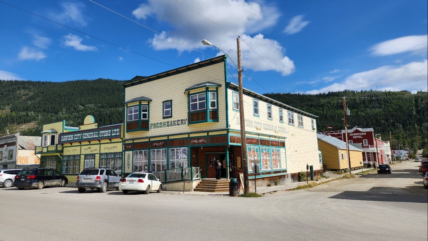
August 21 - Downtown Dawson City
The general story and grocery shown here was jammed from floor to ceiling with every conceivable type of food. I bought fresh Jackfruit which I’ve never had before and golden berries, both delicious. Later that day I went on a walking tour of the town offered by Parks Canada. We were told there are over 50 original gold rush era buildings preserved in Dawson. The tour was given by Gabriela, a woman who came to Dawson on holiday 25 years ago and never left!
She lives in West Dawson, which is across the wide, fast flowing Yukon River from Dawson proper. West Dawson, population 200, is off the grid for both power and water. And in the season between when the ferry and ice roads are functioning, they have no way to get to Dawson or beyond to Whitehorse and civilization. The Top of the World Highway that connects West Dawson west to Tok Alaska closes in winter. I asked Gabriela what she does for those approximately three months of the year and she said they read, study online and socialize.
August 23 - Grouse in Tombstorne Territorial Park
Three grouse on the trail at Tombstone Territorial Park (Km 74 of the Dempster Highway). Tombstone is one of my favorite places on earth. It is so expansive. The North Klondike River runs through it and in the spring and fall the porcupine caribou herd migrates through. That is on my bucket list of things to see but it isn’t easy to travel here in the winter.


August 24 - Sky's Reflection in Two Moose Lake
Reflection of sky in Two Moose Lake. (approx. Km 100 on the Dempster) Today the water was crystal smooth and there were no moose to be seen. But that isn’t always the case. When I was here in 2009, I had a young couple from the Czech Republic travelling with me. They got all excited knowing that Two Moose Lake was coming up. They had never seen a moose. I explained that the name of a location can be inaccurate because animals move around. Never the less, we pulled over at the lake and sure enough two huge moose showed their heads above the water, and we watched them delightedly for some time. Later on that same trip we passed some feature with “wolf” in the name and sadly didn’t see a wolf. I have yet to see a wolf in the wild.

August 24
Arctic Circle
Almost there!
I reached the Arctic Circle today 66’33” north. In this high plateau the colors are changing and I’m staying here for the night. I ‘ve been told there may be northern lights tonight.
August 25 - Fort MacPherson Fish Camp
Fish camp in Fort MacPherson - I passed through the small indigenous community of Fort MacPherson on the Peel river. I decide to explore and pulled into the local Northern Store to look at my map. Another vehicle had pulled in and I met the driver from Oregon and a young couple from Germany who hitched a ride with him. They told me there was a fish camp that welcomed tourists and they were headed there. I asked to tag along.

When we arrived, we were met by Emily, one of three “trainee fish processors”. Every morning fisherman bring their catch of 20, 40 or 100 large whitefish to the camp. Emily and the others gut, scale and fillet the fish and then hang it to smoke for 4 – 5 days. She told us proudly that this is their land and that they are lucky to be able to live their culturally traditional lifestyle. They share the fish with the community, especially the elders. I noted that this is a dry community and everyone I saw around town seemed occupied. She offered us tastes and wow was it good. Before we left, she said with a wry smile that the locals call the town “Fort MudPherson” – how right she was. This mud all over my van, my shoes and my clothes is not normal dirt, easily washed off with a power hose … I have my work cut out when I get back to pavement to make my van Silver again.

August 26 - Inuvik community greenhouse
I was in Inuvik in 2009 and remember seeing it as very down at heel with many people hanging out appearing to be imbibing addictive substances in public. This time, although some of those characters are still around, there are signs of change. I went swimming at the beautiful sports complex - it was clean and well cared for. There was a rowdy baseball tournament happening outside. And I happened on this community greenhouse. The building was donated by the local Aurora College and houses about 100 small plots all lovingly tended by the community either for their own use or to donate to the foodbank. There was an extensive roster of volunteer tasks and there were lots of healthy looking veggies.

August 27 - Pingos outside Tuktoyaktuk
These odd land formations are unique to the area and Parks Canada has designated them a National Landmark and set up two of their famous red chairs facing these large ones. To see them at closer range requires a 40-minute kayak paddle in the Arctic Ocean which I did not do. But I did swim in the Arctic - full body submerged up to the neck! That was exhilarating.
I made it!
I’ve put 5000 km on my vehicle on this trip to get to this farthest point from home. I start south tomorrow and have to drive approximately 3600 km to get home. I’ll keep taking photos if I see more cool things.
Thanks for joining me on the trip.
